GPSMAP® 4010
This mid-sized 4000 series chartplotter fills the gap between the smaller GPSMAP 4008 and the wider GPSMAP 4012. Like its counterparts, the 4010 serves as your all-in-one nerve centre for the Garmin Marine Network. This chartplotter has crisp, video-quality resolution on a 10.4-inch diagonal SVGA display as well as a worldwide, satellite-enhanced basemap. By connecting to the Garmin Marine Network, you can add sonar, radar and video functionality. For even more enhanced features and detailed regional cartography, you can add the optional BlueChart® g2 Vision card.
View Detailed Graphics and Video
The 4010 features a worldwide basemap with high-quality satellite images in place of more traditional maps. A high-speed processor draws maps quickly, while its simple, intuitive interface makes navigation easy. To keep tabs on your engine room or other areas of your boat, you can also connect a live video feed through its video input option.
Add Extras with BlueChart g2 Vision
With optional BlueChart g2 Vision SD cards, you can add a whole new dimension of exceptional features to your chartplotter.
- Choose to view 3D map information at “mariner’s eye view” above the waterline or “fish-eye view” below the water.
- High-resolution satellite images help you orient yourself in unfamiliar areas.
- Auto Guidance technology searches through all relevant charts to automatically create a route from where you are to your destination, avoiding charted obstacles, shallow water, buoys and other obstructions. Just click on your destination and the 4010 does the rest.
Connect to the Garmin Marine Network
The 4010 connects easily to the high-speed Garmin Marine Network, so you can interface with additional multi-function displays and add remote sensors such as the new GFS 10 fuel sensor. Once connected, you can share information between the 4010 and other chartplotters on your boat. You can also add high-powered radar, sonar and video to your system. For easy operation, an optional wireless remote is also available.


| Physical dimensions |
34 x 22.6 x 10.7 cm (13.4″ x 8.9″ x 4.2″) |
| Display size, WxH |
24.6 x 18.5 cm, 26.4 cm diagonal (9.7″ x 7.3″, 10.4″ diagonal) |
| Display resolution, WxH |
800 x 600 pixels |
| Display type |
SVGA display |
| Weight |
3.5 kg (7.8 lb) |
| Water rating |
IPX7 |
| Antenna |
External only |
| NMEA 2000® compatible |
|
| NMEA 0183 compatible |
|
| SiriusXM™ Weather & Radio compatible |
|
| Power consumption |
Max power usage at 10 Vdc: 40 W
Max current draw at 12 Vdc: 2.5 A
|
| Mounting options |
Bail or Flush |
| Garmin Marine Network™ ports |
3 |
Maps & Memory
|
| Preloaded maps |
None |
| Accepts data cards |
1 SD™ card |
| Waypoints |
1,500 |
| Routes |
20 |
| Track log |
10,000 points; 20 saved tracks |
Chartplotter Features
|
| Garmin Radar compatible |
|
| Garmin Sonar compatible |
Yes (with GSD™ black box, sold separately) |
| Supports AIS (tracks target ships position) |
|
| Supports DSC (displays position data from DSC-capable VHF radio) |
|
| Tide tables |
|
| GSD™ Black Box sonar support |
|
| BlueChart® Mobile (planning) compatible |
Yes (Wi-Fi Adapter Kit required, sold separately) |
| Wireless remote compatible |
|
| Wireless mouse compatible |
|
Sonar Features & Specifications
|
| Dual-frequency (50/200 kHz) sonar capable |
Yes (with compatible black box sonar) |
| Dual-beam (77/200 kHz) sonar capable |
Yes (with compatible black box sonar) |
| CHIRP sonar technology |
Yes (with external black box) |
Connections
|
| NMEA 0183 input ports |
4 |
| NMEA 0183 output ports |
2 |
| Video input ports |
2 – RCA composite |
| Video output ports |
1 – VGA |
| Wireless connectivity |
Yes (Wi-Fi Adapter Kit required, sold separately) |
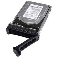 Dell 300GB SAS 6Gbps 15k 2.5" Rear HD Fully Assembled in Standard Carrier, C8220X
1 × AED2,579.00
Dell 300GB SAS 6Gbps 15k 2.5" Rear HD Fully Assembled in Standard Carrier, C8220X
1 × AED2,579.00  Toshiba PH3400U-1I72 4TB 3.5in 6Gbps 7.2K RPM Desktop SATA HDD
1 × AED1,119.00
Toshiba PH3400U-1I72 4TB 3.5in 6Gbps 7.2K RPM Desktop SATA HDD
1 × AED1,119.00  WD Elements Portable 500 GB USB 3.0 Hard Drives
1 × AED199.00
WD Elements Portable 500 GB USB 3.0 Hard Drives
1 × AED199.00  Aruba Instant On SFP to RJ45 Gigabit Transceiver
1 × AED299.00
Aruba Instant On SFP to RJ45 Gigabit Transceiver
1 × AED299.00  SONY REPLACEMENT PROJECTOR LAMP VPL-HS60 VPL-HS51
1 × AED499.00
SONY REPLACEMENT PROJECTOR LAMP VPL-HS60 VPL-HS51
1 × AED499.00 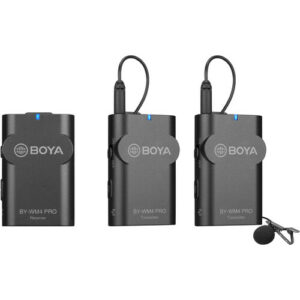 BOYA BY-WM4 PRO-K2 Two-Person Digital Camera-Mount Wireless Omni Lavalier Microphone System (2.4 GHz)
1 × AED899.00
BOYA BY-WM4 PRO-K2 Two-Person Digital Camera-Mount Wireless Omni Lavalier Microphone System (2.4 GHz)
1 × AED899.00  Shure MXC416/C Cardioid Gooseneck Microphone (16")
1 × AED1,199.00
Shure MXC416/C Cardioid Gooseneck Microphone (16")
1 × AED1,199.00  Seagate ST3750640AS 750GB SATA Hard Drive
1 × AED829.00
Seagate ST3750640AS 750GB SATA Hard Drive
1 × AED829.00 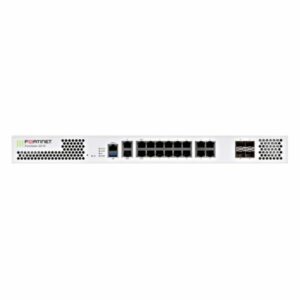 FG-201E - Fortinet NGFW Middle-range Series FortiGate 201E
1 × AED24,699.00
FG-201E - Fortinet NGFW Middle-range Series FortiGate 201E
1 × AED24,699.00 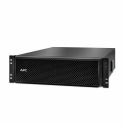 APC SRT192RMBP - 192V 5 AND 8KVA RM BATTERY PACK
1 × AED2,999.00
APC SRT192RMBP - 192V 5 AND 8KVA RM BATTERY PACK
1 × AED2,999.00 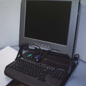 Dell Rack Mount 1U 17" Screen Monitor Display KMM Console Ki
1 × AED1,799.00
Dell Rack Mount 1U 17" Screen Monitor Display KMM Console Ki
1 × AED1,799.00 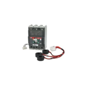 3-Pole Circuit Breaker, 175A, T3 Type for Symmetra PX250/500kW – PD3P175AT3B
1 × AED2,299.00
3-Pole Circuit Breaker, 175A, T3 Type for Symmetra PX250/500kW – PD3P175AT3B
1 × AED2,299.00 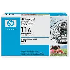 HP LaserJet 2410/2420/2430 Q6511A Black Print Cartridge
1 × AED479.00
HP LaserJet 2410/2420/2430 Q6511A Black Print Cartridge
1 × AED479.00  04 3550600
 052 7036860


There are no reviews yet.