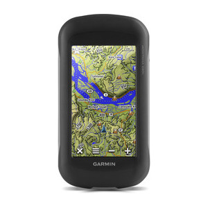
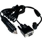
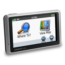
Garmin GPSMAP 496 Atlantic Aviation GPS Portable
Fly smarter and safer with the GPSMAP 496 on board. This “know-it-all” mini-MFD puts more power and information at your fingertips than any other portable handheld in the history of aviation. Similar to the GPSMAP 396, the 496 combines satellite datalink weather with a detailed color map and terrain alerting, then takes it up a notch with even more high-end software and features. The 496 is a “must have” for any pilot.
Garmin SafeTaxi™ data provides detailed taxiway diagrams and position information for over 650 U.S. airports. Preloaded on the unit, this information helps you navigate unfamiliar airports with confidence and shows your aircraft’s exact position on the field.
Look up taxi services, plan an overnight, choose fuel stops and more with the Aircraft Owners and Pilots Association (AOPA) Airport Directory included on the GPSMAP 496. This indispensable reference guide puts a wealth of airport and travel information at your fingertips. It offers detailed information for over 5,300 U.S. airports along with the names and phone numbers of thousands of FBOs, plus ground transportation, lodging, restaurants, local attractions and more.
When in the air, Garmin’s new Smart Airspace feature makes it easier than ever to identify what airspace lies ahead. Smart Airspace automatically highlights airspace close to the pilot’s current altitude and de-emphasizes airspace away from the current altitude, which gives you increased situational awareness.
The GPSMAP 496 features a built-in Jeppesen database with terrain and obstacle databases. Fly with informed confidence thanks to the enhanced, higher-resolution terrain database. With over ten times as much data as the 396’s terrain database, the 496 provides even more visual reference. It monitors your current position in relation to surrounding terrain to provide alerts. Even customize your own minimum clearance levels to receive terrain cautions. With the unit’s Jeppesen® database, you can view your flight route displayed over contour terrain mapping. The addition of private airports and heliports to the database provides even more navigation and emergency “nearest” options.
For added realism and safety, the 496 updates map data and “Panel” page instruments at 5 Hz, a significantly faster update rate that gives you a smoother, near “real-time” presentation of your aircraft’s analog indicators, such as the HSI and turn coordinator.
With an optional subscription to XM WX Satellite Weather™ and the included GXM 30A smart antenna, you’ll have access to constantly-updated, high-resolution weather data for the U.S, right in the cockpit. Weather information includes Next Generation Radar (NEXRAD), Aviation Routine Weather Reports (METARs), Terminal Aerodrome Forecasts (TAFs), Temporary Flight Restrictions (TFRs), Lightning and Winds Aloft, plus more and can be laid directly over the 496’s Jeppesen and topographic map databases. Add a Garmin Mode S transponder, and the 496 will also display TIS traffic alerts that identify surrounding air traffic.
Garmin’s GPSMAP 496 comes ready to go right out of the box with preloaded City Navigator® NT street maps and a hefty points of interest (POIs) database, including motels, restaurants, fuel, ATMs and more. Simply enter a destination, and you’re automatically routed with voice-prompted turn-by-turn directions. In addition, GPSMAP 496 accepts customized points of interest such as school zones and safety cameras and includes proximity alerts to warn you of upcoming POIs. Add optional BlueChart® g2 data cards, and turn the 496 into a color chartplotter.
GPSMAP 496: The world’s most highly evolved aviation portable.
 Hitachi CP-X1 Projector
1 × AED3,799.00
Hitachi CP-X1 Projector
1 × AED3,799.00 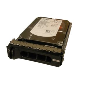 Dell 342-0850 SAS / Serial Attached SCSI SFF Hard Drive Kit
1 × AED399.00
Dell 342-0850 SAS / Serial Attached SCSI SFF Hard Drive Kit
1 × AED399.00 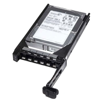 Dell 300GB SAS 6Gbps 10k Hybrid HD Fully Assembled
1 × AED1,029.00
Dell 300GB SAS 6Gbps 10k Hybrid HD Fully Assembled
1 × AED1,029.00  ATX Networks EM-2HD MPEG-2/H.264 Dual HD Encoder Module for PD1000
1 × AED8,699.00
ATX Networks EM-2HD MPEG-2/H.264 Dual HD Encoder Module for PD1000
1 × AED8,699.00 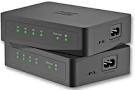 WD NETWORK KIT POWER OVER LINE - NETWORK BY ELECTRICITY
1 × AED119.00
WD NETWORK KIT POWER OVER LINE - NETWORK BY ELECTRICITY
1 × AED119.00 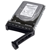 Dell 600GB SAS 6Gbps 15k 9cm (3.5") HD Hot Plug Fully Assembled
1 × AED2,139.00
Dell 600GB SAS 6Gbps 15k 9cm (3.5") HD Hot Plug Fully Assembled
1 × AED2,139.00  Dell 3TB Near-Line SAS 6Gbps 7.2k 3.5" HD Hot Plug Fully Assembled
1 × AED3,399.00
Dell 3TB Near-Line SAS 6Gbps 7.2k 3.5" HD Hot Plug Fully Assembled
1 × AED3,399.00  Huawei S5720-52P-EI-AC switch with 48-ports 1000BASE-T, 4-ports GE SFP, 1xAC power fixed S5720-52P-EI-AC
1 × AED5,799.00
Huawei S5720-52P-EI-AC switch with 48-ports 1000BASE-T, 4-ports GE SFP, 1xAC power fixed S5720-52P-EI-AC
1 × AED5,799.00  HP C4149A Black Print Cartridge for CLJ 8500 /8550 series
1 × AED449.00
HP C4149A Black Print Cartridge for CLJ 8500 /8550 series
1 × AED449.00  Vaddio RoboSHOT 12E HDBT OneLINK HDMI Video Conferencing System - Includes PTZ Camera and HDMI Interface - White
1 × AED29,299.00
Vaddio RoboSHOT 12E HDBT OneLINK HDMI Video Conferencing System - Includes PTZ Camera and HDMI Interface - White
1 × AED29,299.00  Dell 341-7396 / 341-7412 SAS / Serial Attached SCSI Hard Drive Kit
1 × AED899.00
Dell 341-7396 / 341-7412 SAS / Serial Attached SCSI Hard Drive Kit
1 × AED899.00  Dell 341-9580 Universal SATA / USATA Hard Drive CC852 PN939 Kit
1 × AED1,099.00
Dell 341-9580 Universal SATA / USATA Hard Drive CC852 PN939 Kit
1 × AED1,099.00  SanDisk SDSSDHP-064G 64GB 2.5in 6Gbps Ultra Plus SATA SSD
1 × AED599.00
SanDisk SDSSDHP-064G 64GB 2.5in 6Gbps Ultra Plus SATA SSD
1 × AED599.00  Lexmark Optra S feed arm
1 × AED219.00
Lexmark Optra S feed arm
1 × AED219.00  04 3550600
 052 7036860


There are no reviews yet.