-
×
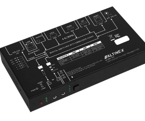 Altinex UT260-103 1 HDMI, 1 DisplayPort, and 1 VGA Auto Switcher with HDBaseT Out
1 × AED2,999.00
Altinex UT260-103 1 HDMI, 1 DisplayPort, and 1 VGA Auto Switcher with HDBaseT Out
1 × AED2,999.00 -
×
 Western Digital WDS250G2B0B 250GB SATA Solid State Drive
1 × AED299.00
Western Digital WDS250G2B0B 250GB SATA Solid State Drive
1 × AED299.00 -
×
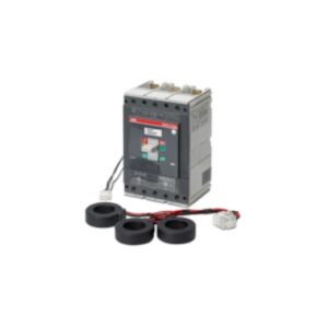 3-Pole Circuit Breaker, 300A, T5 Type for Symmetra PX250/500kW – PD3P300AT5B
1 × AED3,899.00
3-Pole Circuit Breaker, 300A, T5 Type for Symmetra PX250/500kW – PD3P300AT5B
1 × AED3,899.00 -
×
 Lexmark Optra E312 pick up roller
1 × AED139.00
Lexmark Optra E312 pick up roller
1 × AED139.00 -
×
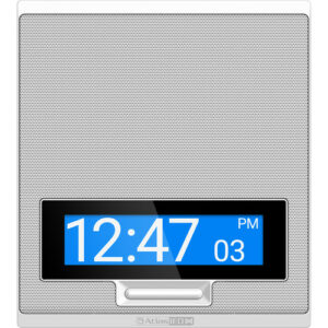 AtlasIED 8" Indoor PoE+ IP Speaker with Talkback Microphone, LCD Display, and LED Flashers
1 × AED6,199.00
AtlasIED 8" Indoor PoE+ IP Speaker with Talkback Microphone, LCD Display, and LED Flashers
1 × AED6,199.00 -
×
 Cisco Audio Science Ceiling Microphone
1 × AED1,999.00
Cisco Audio Science Ceiling Microphone
1 × AED1,999.00 -
×
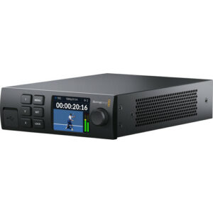 Blackmagic Design 2110 IP Converter 3X3G
1 × AED2,975.00
Blackmagic Design 2110 IP Converter 3X3G
1 × AED2,975.00 -
×
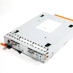 Dell JT356 EMM Module For PowerVault MD1120
1 × AED299.00
Dell JT356 EMM Module For PowerVault MD1120
1 × AED299.00 -
×
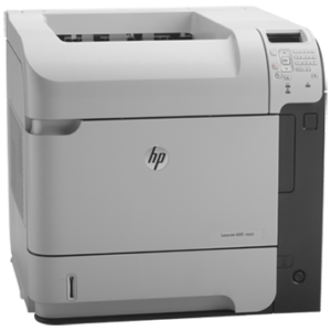 HP LaserJet Enterprise 600 Printer M602n (CE991A)
1 × AED2,819.00
HP LaserJet Enterprise 600 Printer M602n (CE991A)
1 × AED2,819.00 -
×
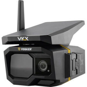 VOSKER VKX Solar-Powered LTE Mobile Surveillance Camera with Night Vision
1 × AED1,299.00
VOSKER VKX Solar-Powered LTE Mobile Surveillance Camera with Night Vision
1 × AED1,299.00 -
×
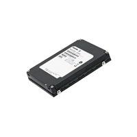 Dell 200GB Solid State Drive SAS Value SLC 6Gbps 2.5in Cabled Drive
1 × AED9,059.00
Dell 200GB Solid State Drive SAS Value SLC 6Gbps 2.5in Cabled Drive
1 × AED9,059.00 -
×
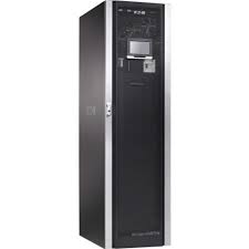 EATON 93PM Battery CAB 1 String 480VDC
1 × AED282,699.00
EATON 93PM Battery CAB 1 String 480VDC
1 × AED282,699.00 -
×
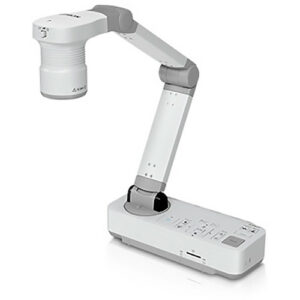 Epson DC-21 Document Camera
1 × AED2,899.00
Epson DC-21 Document Camera
1 × AED2,899.00 -
×
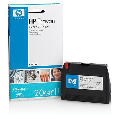 HP Travan 20 GB Data Cartridge
1 × AED329.00
HP Travan 20 GB Data Cartridge
1 × AED329.00 -
×
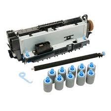 HP CB389-67903 - Maintenancekit 220V
1 × AED1,579.00
HP CB389-67903 - Maintenancekit 220V
1 × AED1,579.00 -
×
 HP 72GB 15K 2.5" SAS DRIVE 431935-B21 432321-001
1 × AED699.00
HP 72GB 15K 2.5" SAS DRIVE 431935-B21 432321-001
1 × AED699.00 -
×
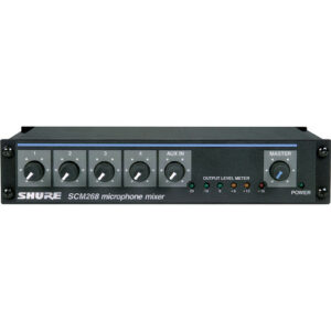 Shure SCM268 4-Channel Microphone Mixer
1 × AED1,799.00
Shure SCM268 4-Channel Microphone Mixer
1 × AED1,799.00 -
×
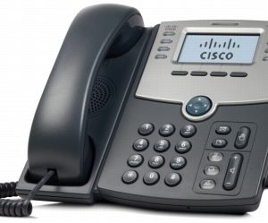 Cisco SPA508G 8-Line IP Phone with 2-Port Switch PoE LCD Display
1 × AED599.00
Cisco SPA508G 8-Line IP Phone with 2-Port Switch PoE LCD Display
1 × AED599.00 -
×
 External HLSMPEA5001AFB HITACHI-BRAND 0S02730
1 × AED419.00
External HLSMPEA5001AFB HITACHI-BRAND 0S02730
1 × AED419.00 -
×
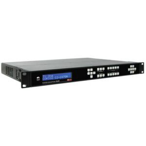 AV Toolbox C2-2375A Universal 3G-SDI Converter
1 × AED24,599.00
AV Toolbox C2-2375A Universal 3G-SDI Converter
1 × AED24,599.00 -
×
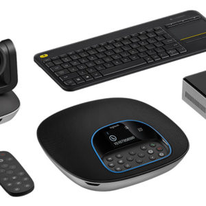 Logitech GROUP KIT Teleconference System with INTEL NUC KIT Core Processor BLKNUC5I5MYHE
1 × AED6,999.00
Logitech GROUP KIT Teleconference System with INTEL NUC KIT Core Processor BLKNUC5I5MYHE
1 × AED6,999.00 -
×
 Shure MXWANI4 4-Channel Audio Network Interface
1 × AED6,599.00
Shure MXWANI4 4-Channel Audio Network Interface
1 × AED6,599.00 -
×
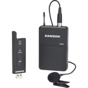 Samson XPD2 Lavalier USB Digital Wireless System
1 × AED499.00
Samson XPD2 Lavalier USB Digital Wireless System
1 × AED499.00 -
×
 TASCAM CD-400U CD/SD/USB Player with Bluetooth and AM/FM Tuner
1 × AED2,299.00
TASCAM CD-400U CD/SD/USB Player with Bluetooth and AM/FM Tuner
1 × AED2,299.00 -
×
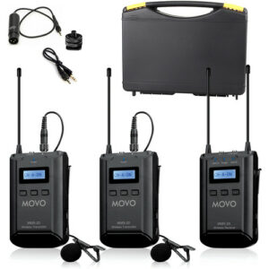 Movo Photo WMX-20-DUO 2-Person Camera-Mount Wireless Lavalier Microphone System (UHF: 556.71 to 595.66 MHz)
1 × AED999.00
Movo Photo WMX-20-DUO 2-Person Camera-Mount Wireless Lavalier Microphone System (UHF: 556.71 to 595.66 MHz)
1 × AED999.00 -
×
 100Base-TX UTP to 100Base-FX MM MTRJ Fast Ethernet
1 × AED375.00
100Base-TX UTP to 100Base-FX MM MTRJ Fast Ethernet
1 × AED375.00 -
×
 Poly Studio E60 Video Conferencing Camera - TAA Compliant
1 × AED10,499.00
Poly Studio E60 Video Conferencing Camera - TAA Compliant
1 × AED10,499.00 -
×
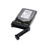 Dell 3TB Near-Line SAS 6Gbps 7.2k 3.5" HD Hot Plug Fully Assembled
1 × AED3,399.00
Dell 3TB Near-Line SAS 6Gbps 7.2k 3.5" HD Hot Plug Fully Assembled
1 × AED3,399.00 -
×
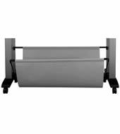 HP Designjet Z6100 60 in Media Bin
1 × AED1,499.00
HP Designjet Z6100 60 in Media Bin
1 × AED1,499.00 -
×
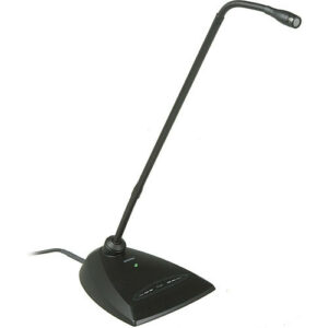 Shure MX418D/C Desktop-Mounted 18" Cardioid Gooseneck Microphone with Preamp
1 × AED1,499.00
Shure MX418D/C Desktop-Mounted 18" Cardioid Gooseneck Microphone with Preamp
1 × AED1,499.00 -
×
Eaton 93PM Battery Cabinet Lithium Ion 486VDC
1 × AED444,099.00
-
×
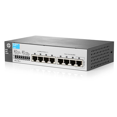 HP 1810-8 Switch
1 × AED349.00
HP 1810-8 Switch
1 × AED349.00 -
×
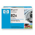 HP LaserJet 8100/8150 series C4182X Black Print Cartridge
1 × AED859.70
HP LaserJet 8100/8150 series C4182X Black Print Cartridge
1 × AED859.70 -
×
 HP LaserJet 5si/mx series C3909A Black Print Cartridge
1 × AED560.00
HP LaserJet 5si/mx series C3909A Black Print Cartridge
1 × AED560.00
Subtotal: AED828,139.70
 04 3550600
 052 7036860


There are no reviews yet.