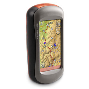
GPSMAP 62s features a 3-axis tilt-compensated compass, a barometric altimeter and supports Custom Maps, BirdsEye™ Satellite imagery (subscription required) and photo navigation. Rugged and waterproof, GPSMAP 62s employs a quad helix antenna for unparalleled reception, has a high-speed USB connection, a sleek new design and connects wirelessly to compatible handheld devices.
Explore
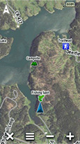
GPSMAP 62s comes with built-in worldwide basemap with shaded relief, so you can navigate anywhere with ease. With photo navigation, you can download pictures from Garmin Connect™ Photos and navigate to them.
Get Your Bearings
GPSMAP 62s has a built-in 3-axis tilt-compensated electronic compass, which shows your heading even when you’re standing still, without holding it level. Its barometric altimeter tracks changes in pressure to pinpoint your precise altitude, and you can even use it to plot barometric pressure over time, which can help you keep an eye on changing weather conditions.
Share Wirelessly
With GPSMAP 62s you can share your waypoints, tracks, routes and geocaches wirelessly with other compatible devices. Your friends can enjoy your favorite hike or cache — simply press “send” to transfer your information.
Keep Your Fix
With its quad helix antenna and high-sensitivity, WAAS-enabled GPS receiver and HotFix® satellite prediction, GPSMAP 62s locates your position quickly and precisely and maintains its GPS location even in heavy cover and deep canyons. The advantage is clear — whether you’re in deep woods or just near tall buildings and trees, you can count on GPSMAP 62s to help you find your way when you need it the most.
Add Maps
Adding more maps is easy with our array of detailed topographic, marine and road maps. With 1.7 GB of onboard memory, you can conveniently download 24K and 100K TOPO mapsand hit the trail, plug in BlueChart® g2 preloaded cards for a great day on the water or City Navigator NT® map data for turn-by-turn routing on roads (see maps tab for compatible maps). GPSMAP 62s also supports BirdsEye Satellite Imagery (subscription required), that lets you download satellite images to your device and integrate them with your maps. In addition, the 62s is compatible with Custom Maps, free software that transforms paper and electronic maps into downloadable maps for your device.
Get Connected
You’ve been busy exploring and now you want to store and analyze your activities. With a simple connection to your computer and to the Internet, you can get a detailed analysis of your activities and send tracks to your outdoor device using Garmin Connect™. This one-stop site offers an activity table and allows you to view your activities on a map using Google™ Earth. Explore other routes uploaded by millions of Garmin Connect users and share your experiences on Twitter® and Facebook®. Getting started is easy, so get out there, explore and share.
Find Fun
GPSMAP 62s supports geocaching GPX files for downloading geocaches and details straight to your unit. By going paperless, you’re not only helping the environment but also improving efficiency. GPSMAP 62s stores and displays key information, including location, terrain, difficulty, hints and descriptions, which means no more manually entering coordinates and paper printouts! Simply upload the GPX file to your unit and start hunting for caches. Slim and lightweight, 62s is the perfect companion for all your outdoor pursuits.
Plan Your Next Trip
Take charge of your next adventure with BaseCamp™, software that lets you view and organize maps, waypoints, routes, and tracks. This free trip-planning software even allows you to create Garmin Adventures that you can share with friends, family or fellow explorers. BaseCamp displays topographic map data in 2-D or 3-D on your computer screen, including contour lines and elevation profiles. It also can transfer an unlimited amount of satellite images to your device when paired with a BirdsEye Satellite Imagery subscription.
Specifications
Physical & Performance:
|
| Unit dimensions, WxHxD: |
2.4″ x 6.3″ x 1.4″ (6.1 x 16.0 x 3.6 cm) |
| Display size, WxH: |
1.43″ x 2.15″ (3.6 x 5.5 cm); 2.6″ diag (6.6 cm) |
| Display resolution, WxH: |
160 x 240 pixels |
| Display type: |
transflective, 65-K color TFT |
| Weight: |
9.2 oz (260.1 g) with batteries |
| Battery: |
2 AA batteries (not included); NiMH or Lithium recommended |
| Battery life: |
20 hours |
| Waterproof: |
yes (IPX7) |
| Floats: |
no |
| High-sensitivity receiver: |
yes |
| Interface: |
high-speed USB and NMEA 0183 compatible |
Maps and Memory:
|
| Basemap: |
yes |
| Preloaded maps: |
no |
| Ability to add maps: |
yes |
| Built-in memory: |
1.7 GB |
| Accepts data cards: |
microSD™ card (not included) |
| Waypoints/favorites/locations: |
2000 |
| Routes: |
200 |
| Track log: |
10,000 points, 200 saved tracks |
Features and Benefits:
|
| Automatic routing (turn by turn routing on roads): |
yes (with optional mapping for detailed roads) |
| Electronic compass: |
yes (tilt-compensated, 3-axis) |
| Touchscreen: |
no |
| Barometric altimeter: |
yes |
| Camera: |
no |
| Geocaching-friendly: |
yes (paperless) |
| Custom maps compatible: |
yes |
| Photo navigation (navigate to geotagged photos): |
yes |
| Hunt/fish calendar: |
yes |
| Sun and moon information: |
yes |
| Tide tables: |
yes |
| Area calculation: |
yes |
| Custom POIs (ability to add additional points of interest): |
yes |
| Unit-to-unit transfer (shares data wirelessly with similar units): |
yes |
| Picture viewer: |
yes |
| Garmin Connect™ compatible (online community where you analyze, categorize and share data): |
yes |
 AVer Audio/Speaker POD for VC520-POD
1 × د.إ1,999.00
AVer Audio/Speaker POD for VC520-POD
1 × د.إ1,999.00  Hitachi CP-X300
1 × د.إ4,599.00
Hitachi CP-X300
1 × د.إ4,599.00  Tripp Lite P776-006 KVM USB Cable Kit for B020/B022 Series Switches - 6ft
1 × د.إ119.00
Tripp Lite P776-006 KVM USB Cable Kit for B020/B022 Series Switches - 6ft
1 × د.إ119.00  Garmin Edge 1000 Color Touchscreen GPS Bundle
1 × د.إ2,599.00
Garmin Edge 1000 Color Touchscreen GPS Bundle
1 × د.إ2,599.00  Seagate XP480LE30002 480GB PCIe NVMe Solid State Drive
1 × د.إ2,999.00
Seagate XP480LE30002 480GB PCIe NVMe Solid State Drive
1 × د.إ2,999.00  ZyXEL USG FLEX 100 Firewall (V2)
1 × د.إ1,699.00
ZyXEL USG FLEX 100 Firewall (V2)
1 × د.إ1,699.00  Cisco IE2000 with 8FE Copper ports and 2GE Combo (Enhan. Lan Base)
1 × د.إ5,799.00
Cisco IE2000 with 8FE Copper ports and 2GE Combo (Enhan. Lan Base)
1 × د.إ5,799.00  DIR-685/EEU Wireless 300Mbps N Storage Router
1 × د.إ819.00
DIR-685/EEU Wireless 300Mbps N Storage Router
1 × د.إ819.00  Swift LED Stereo Microscope SM105
1 × د.إ2,999.00
Swift LED Stereo Microscope SM105
1 × د.إ2,999.00  Intel SSDSC2BB800G4T 800GB 6Gbps SATA 2.5" MLC Enterprise Class DC S3500 Series SSD
1 × د.إ5,379.00
Intel SSDSC2BB800G4T 800GB 6Gbps SATA 2.5" MLC Enterprise Class DC S3500 Series SSD
1 × د.إ5,379.00  Behringer Xenyx X1204USB Premium 12-Input 2/2-Bus Mixer with USB
1 × د.إ1,099.00
Behringer Xenyx X1204USB Premium 12-Input 2/2-Bus Mixer with USB
1 × د.إ1,099.00  Dell 900GB Self-Encrypting SAS 6Gbps 10k 6cm (2.5") HD Hot Plug Fully Assembled, FIPS140-2
1 × د.إ2,939.00
Dell 900GB Self-Encrypting SAS 6Gbps 10k 6cm (2.5") HD Hot Plug Fully Assembled, FIPS140-2
1 × د.إ2,939.00  AIR-AP1141N-P-K9 1140 Series Access Points: Single Band
1 × د.إ3,999.00
AIR-AP1141N-P-K9 1140 Series Access Points: Single Band
1 × د.إ3,999.00 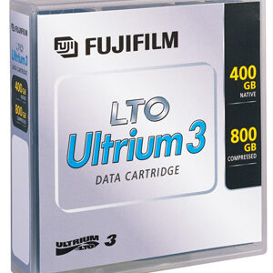 Fujifilm LTO-3 26230010 - Data Cartridge Tape, LTO, Ultrium-3, 400/800GB Fuji LTO3 Ultrium
1 × د.إ899.00
Fujifilm LTO-3 26230010 - Data Cartridge Tape, LTO, Ultrium-3, 400/800GB Fuji LTO3 Ultrium
1 × د.إ899.00 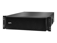 APC SRT192RMBP2 Smart-UPS SRT 192V 8kVA and 10kVA RM Battery Pack
1 × د.إ5,999.00
APC SRT192RMBP2 Smart-UPS SRT 192V 8kVA and 10kVA RM Battery Pack
1 × د.إ5,999.00 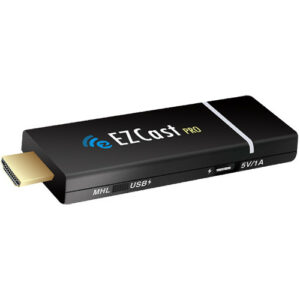 EZCast Pro Dongle
1 × د.إ399.00
EZCast Pro Dongle
1 × د.إ399.00 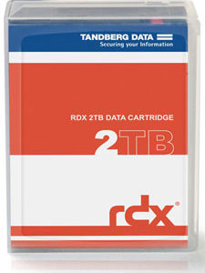 Tandberg Data RDX QuikStor 2TB - Removable Disk Cartridge P/N: 8731-RDX (Dell RD1000 Compatible) 8731-RDX
1 × د.إ1,299.00
Tandberg Data RDX QuikStor 2TB - Removable Disk Cartridge P/N: 8731-RDX (Dell RD1000 Compatible) 8731-RDX
1 × د.إ1,299.00  NETGEAR WAC564 1733 Mbit/s White Power over Ethernet (PoE)
1 × د.إ1,199.00
NETGEAR WAC564 1733 Mbit/s White Power over Ethernet (PoE)
1 × د.إ1,199.00  04 3550600
 052 7036860


There are no reviews yet.